
Provenance, Error, and Uncertainty
Uncertainty in Geographic Research
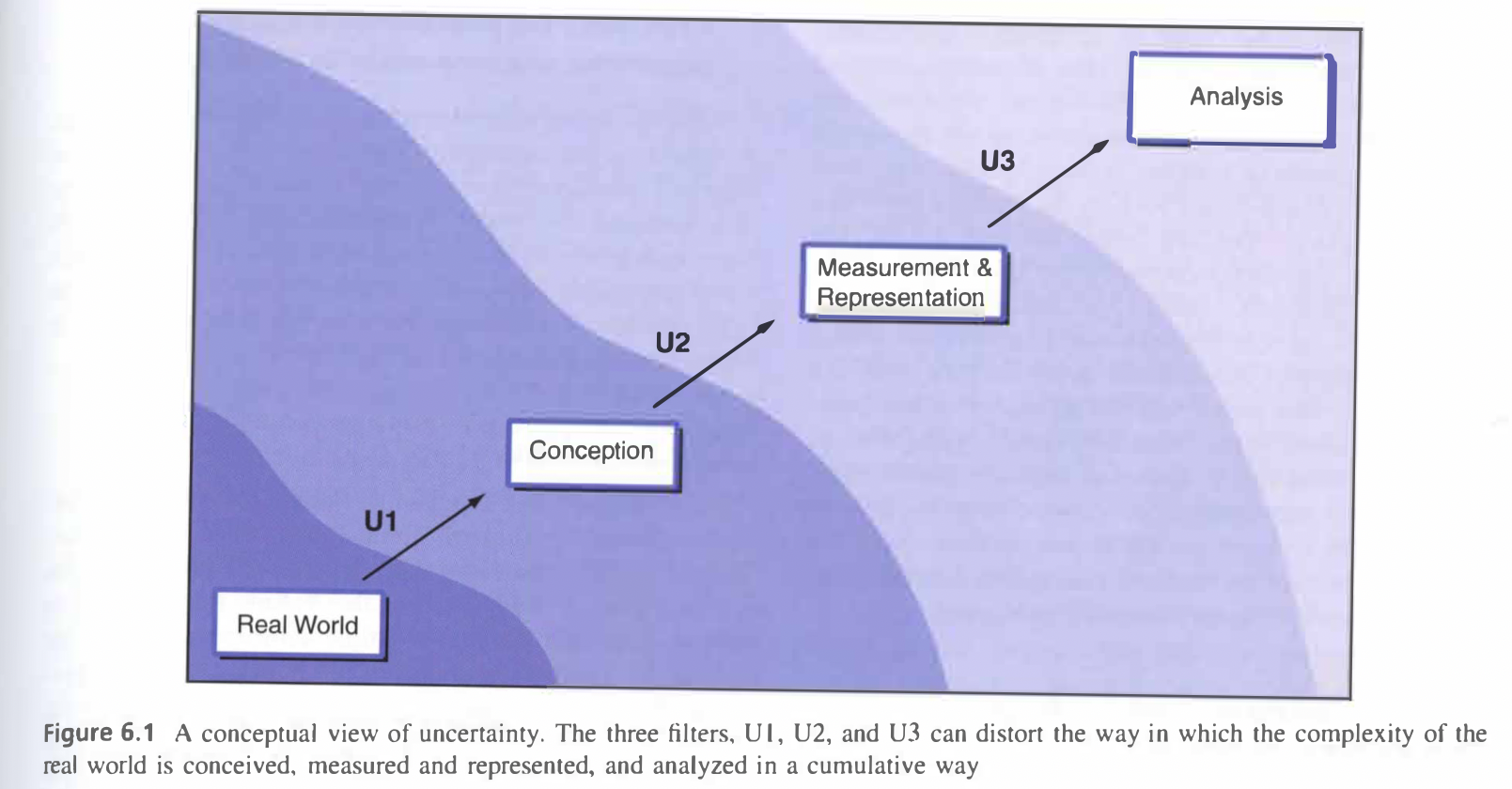 Figure 6.1 Chapter 6, “Uncertainty,” by Longley et al. (2008)
As a member of a geography research team, I have been a part of a conversation regarding decisions and methods to deal with uncertainty. Due to time pressure and poor organization and planning, do-files are often forgotten and in-between steps are not saved properly in QGIS. These poor documentation and black-box workflows are avoided if possible, but often end up happening. In this situation, while results may be produced, any reworking or running statistical tests on any of the data will require, in most cases, starting basically from scratch.
As researchers, geographers have the responsibility to both attempt to minimize uncertainty in their analysis and data sources, and diligently report all possible sources of uncertainty that may arise in their study. All cartography and GIS are imperfect representations of the real world, so uncertainty is inherent in the data and type of work being conducted. Understanding this and being transparent about the process is paramount. Some ways recommended by Longley et al. to minimize uncertainty are by using multiple reputible data sources if possible, being diligent about the quality of the data and metadata provided, and understand that uncertainties in outputs of GIS analysis are often larger than might be expected, due to snowballing of uncertainty that might occur during the analysis.
Uncertainty is an inherent part of research, and geographical research using GIS is no different. Researchers have the responsibility to clearly publish this aspect of research, and not shy away from uncertainty graphs or explaining the limitations of their data.